![]()
ITD using LIDAR to map Idaho highways
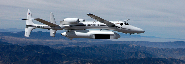
It’s a new technology, at least for ITD. The acronym LiDAR means “Light Detection and Ranging,” and consultants are using it to map Idaho highways.
The process consists of scanning the Earth’s surface with pulsed laser light. A plane equipped with LiDAR gear flies over and along the highways, gathering data that builds digital terrain models. Models help ITD manage assets, design new projects and plan ways to improve highway corridors.![]()
ITD is supporting the mission of the Idaho LiDAR Consortium (www.idaholidar.org) to further the process in Idaho. The consortium aims to bring state and federal agencies together in identifying opportunities to use LiDAR.
LiDAR mapping is quicker than traditional surveying. The process is capable of gathering more data in one day than a ground crew could collect in a year. Technicians import data into Microstation and ArcGIS software to visualize landforms, water channels and buildings, not to mention help design improvements to the state highway system.
Engineers make the data available (https://www.idaholidar.org/data/data-map/) for use by public and private agencies in floodplain mapping, biological studies, and geotechnical risk management, under a concept called The Idaho Map (https://gis.idaho.gov/).
Using this system, District 5 mapped state highways in southeast Idaho last year, and District 6 is using the system to map state highways in eastern Idaho this year.
“When public and private agencies coordinate technology use and results, they lift each other while making better use of taxpayer dollars,” said Project Manager Brad Richards at District 6. “LiDAR is improving ITD planning and efficiency.”
How does it work? (see https://en.wikipedia.org/wiki/Lidar)
“The airborne laser fires rapid laser pulses at a surface, and a sensor on the instrument measures the amount of time it takes for each pulse to bounce back – building a detailed elevation map, point by point.” (“No national system to track landslide hazards,” Gosia Wozniacka, Associated Press, Post Register, March 31, 2014)
Aero-Graphics Inc. (801-487-3273), of Salt Lake City, is the main consultant for ITD’s LiDAR work, with J-U-B Engineers Inc. (208-376-7330), of Boise, a subconsultant.
Published 07-28-17