![]()
Utah's 'UPlan' combines geographic data and engineering
What began as a marriage of convenience has blossomed into an enduring relationship with unlimited potential.
GIS, meet engineering.
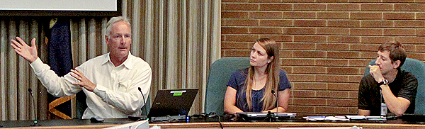
Utah Department of Transportation representatives discussed the successful use of geographic information systems (GIS) as a planning and design tool with an inquisitive audience at Headquarters on Monday.
More than 70 employees, representing a broad cross-section of ITD disciplines learned how UDOT combined GIS into highway engineering. It began as a planning tool but the model has been so successful staff members find it challenging to keep with the requests for publishing new data, said John Thomas, UDOT Director of Planning.
UPLAN publishes the department’s geospatially linked data, enabling users to access information about projects, corridor studies, environmental considerations, etc., to the level of detail they desire. Users have the flexibility to choose the data sets – or layers –provided by the Utah Department of Transportation and other partners, including utilities and local highway jurisdictions.
 The system dynamic is constantly evolving and “customizable,” Thomas said. GIS analysts – UDOT has two full-time and one part-time – are becoming one of the most valuable assets in the engineering process, Thomas said.
UDOT is on the front edge of integrating GIS and engineering. Today, Thomas said, many off-the-shelf programs have emerged and are making the process faster and smoother.
In response to a question from the audience, he recommended identifying a starting point and moving forward rather than trying to capture historic data from previous projects. As time allows, you might want to begin adding data from earlier projects, but it will be a challenge just to keep pace with today’s demands, he suggested.
UPlan strengthens relationships with traditional partners, improves transparency and trust, and provides a new level of customer service. Utah’s system began at the staff level, a grassroots planning initiative that continues to expand. Physical boundaries don’t matter, Thomas said, citing a new collaborative effort involving Nevada, California, Arizona and Utah in Interstate 15 corridor planning.
UDOT introduced its planning tool to District 6 in eastern Idaho and has offered support to share lessons learned with ITD if the department chooses to develop a similar GIS-based planning tool.
ITD is very interested in having the ability to view data in an easily navigable GIS setting, said Erika Bowen, Planning/Program Management Supervisor, who coordinated the UDOT presentation.
“As we investigate the potential of creating something similar, I want to make sure the application not only publishes information provided by ITD and other agencies, but that it becomes our automatic ‘go-to’ tool that will help each of us in our everyday jobs,” Bowen said.
Published 8-12-2011