![]()
More than 200 inches of snowfall last year made for active avalanche-threat season on U.S. 12; ITD’s avalanche forecasters again ready
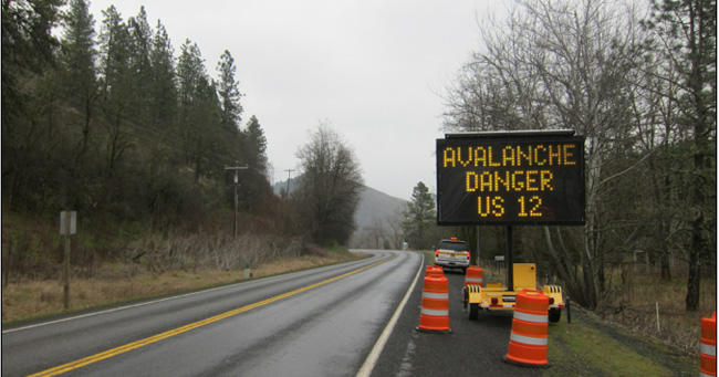
Last year was the most active avalanche-threat season in decades on U.S. 12 through north-central Idaho. The highway may be subjected to avalanches again this winter. But regardless of what Mother Nature brings, ITD and the Avalanche Forecast Team will be ready, unit manager Bill Nicholson explains.
The vision of ITD’s Avalanche Safety Program is to keep US12 safe by continuously monitoring weather and snow conditions, and if the risk of an avalanche is too great, ITD will proactively close and evacuate the highway as a precaution before an actual slide hits the roadway that could compromise public safety.
“The goal of the program is to always give advanced notice of closures, but due to sometimes rapidly changing weather conditions at times, this may not always be possible,” said Nicholson.
“National climatologists are stating that we may have a drier and warmer winter in northern Idaho. We may not have much of a snowpack in the lower canyon, but we will be prepared for whatever comes,” explained Chantel Astorga of the ITD Avalanche Forecast Unit.
Astorga’s assertion underscores the fact that there are too many variables to make a prediction this early in the avalanche season. Weakened snowpacks can be a trigger. Rapid warming immediately following snowfall also can trigger activity. So too can precipitation, creating a “wet slide.”
A wet slide is an avalanche caused by snow losing its strength after becoming damp, moist or saturated with water.
“Avalanches occur naturally when the bonds that hold the winter snowpack together break from the additional stresses created by weather factors such as rain, wind, rising temperatures or the weight of new snow,” said Nicholson.
ITD’s avalanche technicians use information from a network of weather stations, snowpack observations and special weather forecasts for the area from the National Weather Service to determine if avalanches are likely to occur.
Nicholson’s crew uses avalanche weather stations at Powell, at the top of Lolo Pass, and many weather stations from the Forest Service and those used by Montana DOT to compile the threat assessments.
When the highway must be closed due to actual slides or the imminent threat of them, avalanche gates located about two miles east of Lowell and about two miles west of Powell will be manually dropped down across the road to signify the closure. The gates were dropped on five different occasions in February and March during the last season.
Nicholson recommends checking Idaho Traveler Services at 5-1-1 for the latest highway and weather conditions. For online updates, visit 511.idaho.gov. Telephone and Web reports are available 24 hours a day and are updated as conditions change.
Last year, snowfall measured 203 inches in Powell, site of one of ITD’s 13 maintenance sheds in the region. The 61-mile stretch of U.S. 12 from Lowell to Powell is the most potentially problematic area in the Idaho Panhandle area on the highway. There are numerous small “cut banks” further north, closer to the Lolo Pass into Montana that could become an issue during high avalanche hazards.
Prior to the first February closure last season, the last closure for an actual avalanche was in Jan. 2008. That closure lasted for 15 days. The road also closed twice in Jan. 2009 for avalanche danger and control work, not actual slides.
Published 01-16-15