
| CONNECTIONS |
IDAHO
ITD
HOME
511 TRAVEL SERVICES
IDAHO
DMV
ITD
NEWS
HIGHWAY
SAFETY
IDAHO STATE POLICE
STATE OF IDAHO
NIATT
NATIONAL
AASHTO
AAMVA
AAA of IDAHO
FEDERAL HIGHWAYS
FEDERAL AVIATION
IDAHO STATE POLICE
NHTSA
NTSB
TRB
U.S. DOT
TRANSPORTER
Archives
Milestones
Comments
Idaho
Transportation
Department
Office of Communications
P.O. Box 7129
Boise, ID 83707
208.334.8005
Fax: 208.334.8563
![]()
Despite heavy snowfall, Idaho 21 avalanche closures
kept to minimum through constant vigilance
The month of May brings images of daffodils, tulips and other early spring bulbs, as well as the color of green returning to lawns and trees. In Idaho’s high country, however, white still dominates nature’s canvas as the remnants of winter’s snowpack slowly turns to spring runoff.
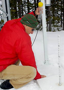
For ITD’s avalanche team, May 1 signals the end of digging snow pits and collecting data, and preparation of a season-ending report.
The avalanche season officially runs from Dec. 1 to May 1.
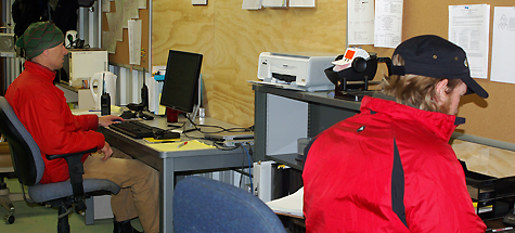
ITD’s lead avalanche forecaster Bill Nicholson released the annual avalanche report this week, reviewing efforts to keep Idaho 21 open through Canyon Creek. That segment – connecting Banks and Lowman – is the state’s most challenging stretch for avalanche control because it contains most of the chutes that potentially impact traffic.
The intent is to limit highway closures as much as possible.
According to the report, 45 avalanches reached the highway between Banner Summit and Grandjean this year. However, the road was closed to traffic for only about 21 days.
That’s good news for the growing communities of Stanley, Challis and Salmon, as well as for recreational traffic destined for the mountains of central Idaho.
 Nicholson credits this year’s success to the hard work of his staff, which includes Mick Riffie and Todd Hannon. The avalanche forecaster also attributes the success to improved coordination with the National Weather Service. Twice-daily weather forecasts “greatly improve forecast confidence,” he explains.
“Avalanche rescue equipment was also improved,” Nicholson reports. “New transceivers where put in service to replace old ones and take advantage of new technology. Avalanche rescue shovels and probes are now located on every piece of equipment and all caches in Canyon Creek.”
Still, Nicholson says more can be done to limit closures and improve safety.
“Our instrumentation and data collection could still be greatly improved,” he writes in the report. He calls for better wind and precipitation gauges at the three weather stations along the route, as well as software to record weather data in an easy-to-use and archive format designed specifically for avalanche forecasting.
The avalanche team also uses an Avalaunche and hand-placed explosives to test the stability of snow chutes and to release snow in a timely and controlled manner.
“In future years, we believe that a permanent avalauncher tower at the 97-mile marker could be utilized,” Nicholson adds. “Also track sensors and avalanche guards for the large paths should be studied.”
The snow total for the season in Canyon Creek was 330 inches. The 11-mile section contains 54 avalanche chutes. Often called “avalanche alley,” the Canyon Creek corridor experiences about 90-percent of the state’s avalanches that threaten highways.
Published 5-15-09