![]()
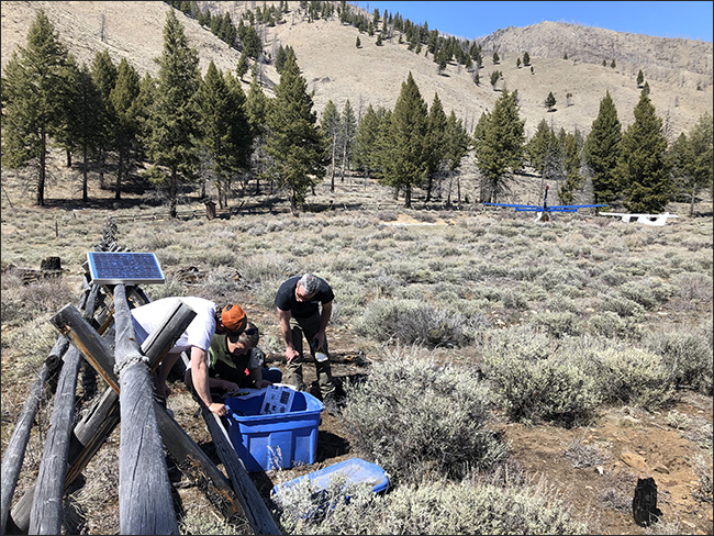
Geologists from Idaho Geologic Survey and a technician from Boise State University put together the seismic equipment.
Shakin' Up The Backcountry
ITD Division of Aeronautics aids in response
to 6.5-magnitude earthquake
This story was a collaboration between:
Ross Engle, Director of Flight Operations, Aeronautics
Tammy Schoen, Administrative Assistant, Aeronautics
Tim Steffen, Safety/Education Coordinator, Aeronautics
Claudio Berti, Geologists, Idaho Geologic Survey
As the Idaho Transportation Department (ITD) watched the snow accumulate in the Central Mountains of Idaho on March 31, we wondered if this would be the storm to shut down Idaho Highway 21. The snow subsided after around 27 inches of beautiful new white fluff came down. Every year, that much snow brings the strong possibility of avalanches onto the roadway along the Canyon Creek section of ID-21 from Grandjean to Banner Summit, and sure enough, that section closed at 2 p.m. that day.
As if there wasn’t enough going on in the world, having been sent home the week before due to COVID-19, March 31 also brought a little ‘shake-up’ to the central portion of Idaho with a 6.5-magnitude earthquake!
The earthquake caused rock slides on Idaho’s roads, including Idaho Highway 75 near Stanley, Highway 21 north and south of Lowman, Idaho Highway 55 between Horseshoe Bend and Cascade, and Idaho Highway 52 east of Emmett. ITD crews attempted to respond immediately, but due to hundreds of aftershocks, they were forced to wait until it was safe enough to assess damage and begin to move rock.
With roads blocked, on April 2, ITD Division of Aeronautics Safety/Education Coordinator Tim Steffen flew ITD over the affected areas to explore the damage. They checked Highway 21, Bull Trout Lake, the epicenter on Shake Creek, Seafoam Mine, and the Middle Fork of the Salmon River. This survey gave ITD D3 engineers a much better understanding of what lay between the rock slides on Highway 21 so crews could safely start their clean up. 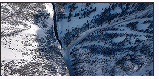
While an estimated 2,000 cubic yards of debris was cleared from Highway 21 (see photo gallery of rockslides), Aeronautics also helped in the earthquake research efforts. On April 9, Aeronautics Director of Flight Operations Ross Engle flew geologists and researchers from the Idaho Geological Survey (IGS) and Boise State University to the Upper Loon and Thomas Creek airstrips in the state’s Kodiak Aircraft, to install seismographs in remote areas near the epicenter of the earthquake.
This equipment surrounds the seismic area and is currently monitoring aftershocks to provide valuable information to geologists.
Pictured at left: Flying over the avalanche that blocked the Salmon River.
Each station consists of a Trillium sensor buried in the ground, a data logger, a power box, a GPS receiver, and a small photovoltaic array and battery as a power source, most of which is contained in a waterproof enclosure.
The team of geologists plan to have the seismograph stations in place for an extended amount of time to help monitor the aftershock sequence initiated by the March 31 earthquake. They will periodically visit the stations to check on their status and retrieve data for analysis.
For up-to-date information regarding the earthquake, see the IGS ‘Stanley Earthquake’ website link: https://www.idahogeology.org/stanley-earthquake
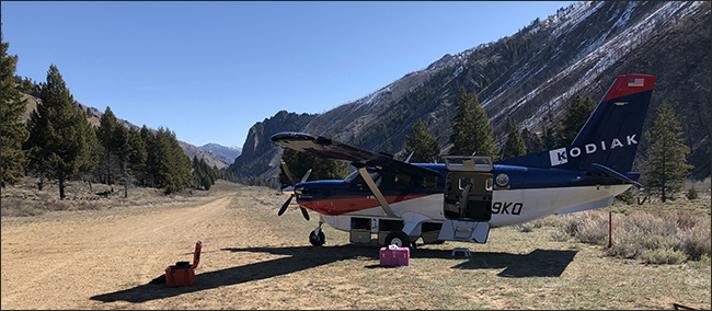
Unloading the seismic equipment from the Kodiak.
Published 04-24-20