![]()
Emerging technologies allow D5 inspectors
to streamline timeframes and improve final product
![]()
District 5’s project inspectors have begun working new technological innovations into their regular tasks, including mobile devices, GPS, and aerial drones. These technologies offer a variety of improvements to their work, making jobs more efficient and data collection more accurate.
Mobile technology has advanced rapidly in recent years, and mobile phones are now ubiquitous amongst the American public. Phone calls and internet access are available to users in increasingly remote areas that would have been unthinkable only a few decades ago. Today, ITD’s project inspectors use these devices to communicate and record information on construction sites.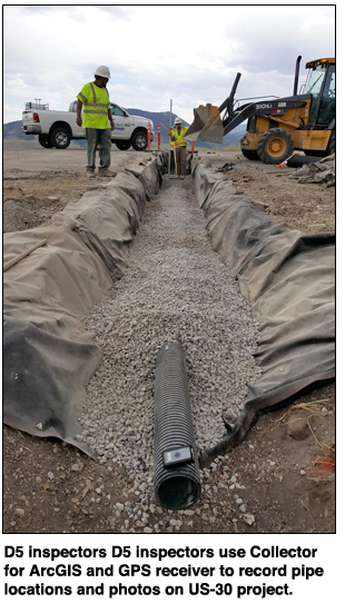
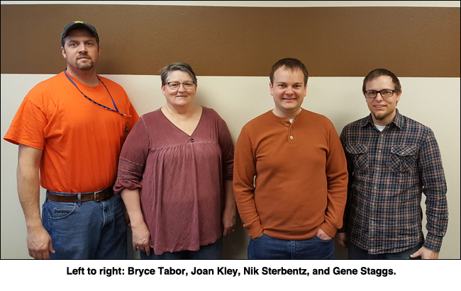
D5 project inspector Joan Kley used her mobile phone to identify temperature and humidity on the US-30 mill-and-inlay/wildlife fence project’s daily work record. She also was able to photograph certain project locations, infrastructure, and equipment for the project team’s immediate use back in the office.
“The smart phone allowed me to text photos and information and get feedback right on the spot, in the field. The flip-phone I had before didn’t allow me to do that,” Kley said.
On the US-30 Bannock County to Lund job, D5 project inspector Bryce Tabor used his mobile phone to video-record the traffic-control setup. On this project, a number of underdrains required replacement. The existing pipes were difficult to locate, having been installed without definitive location information recorded. During their replacement, with assistance from D5 GIS Analyst Nik Sterbentz, Tabor installed the Collector for ArcGIS application on his ITD phone and was able to add the pipe-end locations directly to the existing GIS culvert inventory to record their location for future reference.
Adding Collector for ArcGIS to his mobile device allowed Tabor to record the pipe locations during his regular inspection of the project while construction was in progress.
“We’ve typically hired surveyors for things like locating the pipes, and we have to schedule around that work. With Collector on the mobile phone, I got the point locations while I was performing regular work tasks on the site. Being able to quickly map these is much more convenient,” Tabor said.![]()
Tabor and Sterbentz also leveraged GPS capability in an innovative approach to measuring quantities needed to build new wildlife fences. On the US-30 wildlife fence project, several miles of fence were installed. Traditional methods of measurement for estimating fencing costs have limitations, primarily being cumbersome – some terrain is difficult to negotiate, even with the lightweight measuring wheel.
Retaining the measuring wheel as a quality control measure, Tabor used a handheld GPS device to take the coordinates of each fence corner and support structure. Sterbentz then used these coordinates to draw in fence lines and record the total length of the fences. Each drawn measurement was found to be less than 2% different from the measuring wheel measurement, close enough to provide an estimate of the fence lengths for use by the construction team.
District 5 has also been looking at the use of drone technology for various purposes on construction projects. Materials Engineer Gene Staggs hopes to use the technology to measure vegetation growth from reseeding construction projects. Although revegetation is standard in many ITD projects, it has often been difficult to assess the quality.
Definitive methods of measuring plant growth are available, such as the use of a near-infrared sensor to measure the greenness of a swath of vegetation. Drone technology may enable ITD to near-infrared-scan the area to be revegetated for initial greenness, then use subsequent scans to measure the vegetation’s growth over time to ensure that the reseeding is effective. This could ensure a consistent standard be met on all of ITD’s projects.
Currently the first drone scans are complete, with a drone flight having recorded the reseeded locations, performed by D5 Intern Jesse Weatherly. Additional flights will take place this spring to measure plant growth in those areas.
“The overall goal with using emerging technologies is to do things safer, better, and faster. After a few more trials, the next step will be a cost-benefit analysis, where we hope to see a positive impact,” Staggs said.
Published 02-08-19